Early explorers and settlers to Devonport
Early explorers and settlers to Tasmanian tended to bypass the Mersey River, as it was blocked by a sandbar and the banks were heavily timbered.
It wasn’t until 1826 that the first close investigations of the River were made by the advance party of the Van Diemen’s Land company, and on 7 July of that year, the river received its name, after the River Mersey in Liverpool, England.
In 1835, the Frogmore settlement – now known as Latrobe – became the focus of life in the district, as vessels small enough to cross the bar could sail up the river to this point and there was plenty of good land along the Mersey flats.
The first settler, Charles Oldaker, established himself beside the Mersey estuary on the eastern shore of the river in 1851. It was here that coal was discovered. The discovery of coal came at a crucial time for the development of the Mersey, attracting both population and capital. An increase in shipping activity on the river also created an easier escape route for convicts wishing to escape from Victoria. The estuary became the main port, serving the region.
By the mid-1850s, the level of activity in the region gave rise to the development of the twin settlements of Formby (on the western side of the river) and Torquay (on the eastern side of the river). Timber fast became the most profitable industry in the surrounding forests of the Mersey, and in 1854 a sawmill was established at Torquay, just below the site of the Victoria Bridge. To serve this mill and its settlement, the first wharf was constructed.
John Drake and William Holyman established the first shipyards at Torquay in 1855, providing the settlement with a solid basis for future growth. In 1856 the first roads were built, which cemented the Mersey River as the hub of the Devon region.
By 1860 both Torquay and Formby were well established, with Torquay the clear leader with a police post, magistrate, at least three hotels, shipyards and stores. By comparison, Formby was a straggling little community.
Over the next ten years, the road network continued to grow, and light bridge was constructed over the Mersey at Latrobe, with others spanning the Don, Forth and Leven Rivers also constructed.
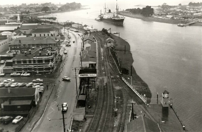
Between 1870-1880 the shipping industry increased. Several attempts were made to deepen the sand bar, and it wasn’t until 1890 that real progress was made, with the deepening of the entrance to its present 24 feet.
The first regular steamer service operating directly between the Mersey and Melbourne was established in the 1880s, and by 1885 the railway was extended from Deloraine to Formby.
The North West Post – Formby’s first newspaper – began circulation in 1887 and continued until 1916 when it was amalgamated with The Advocate.
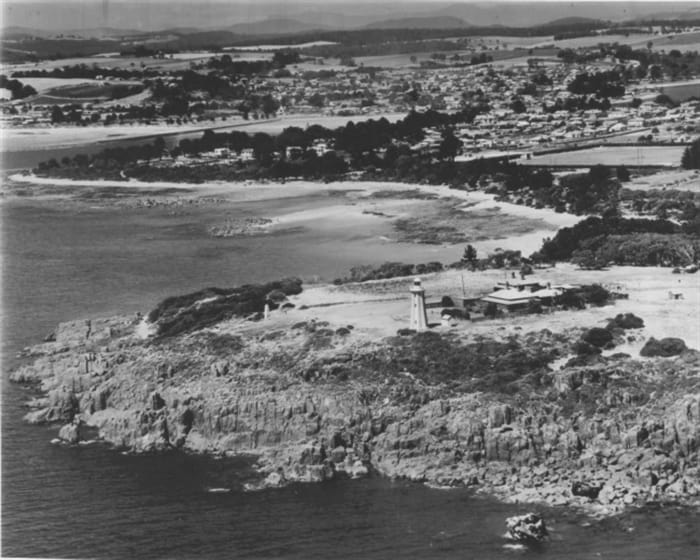
The Mersey Bluff Lighthouse was completed in 1889.
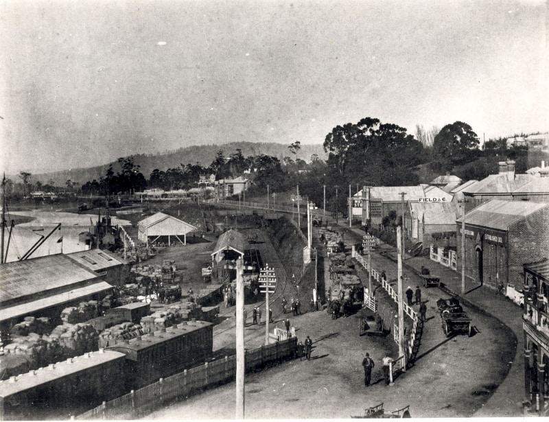
The railway made a significant difference to life in Formby during the early 1900s, combining a railhead and port facilities in the one place. A wharf was created on the west side of the bank close to the railway, and railway sidings, goods yards and warehouses were situated in the main wharf area. The railway brought a building boom to Formby, which now surged ahead of Torquay in size and importance.
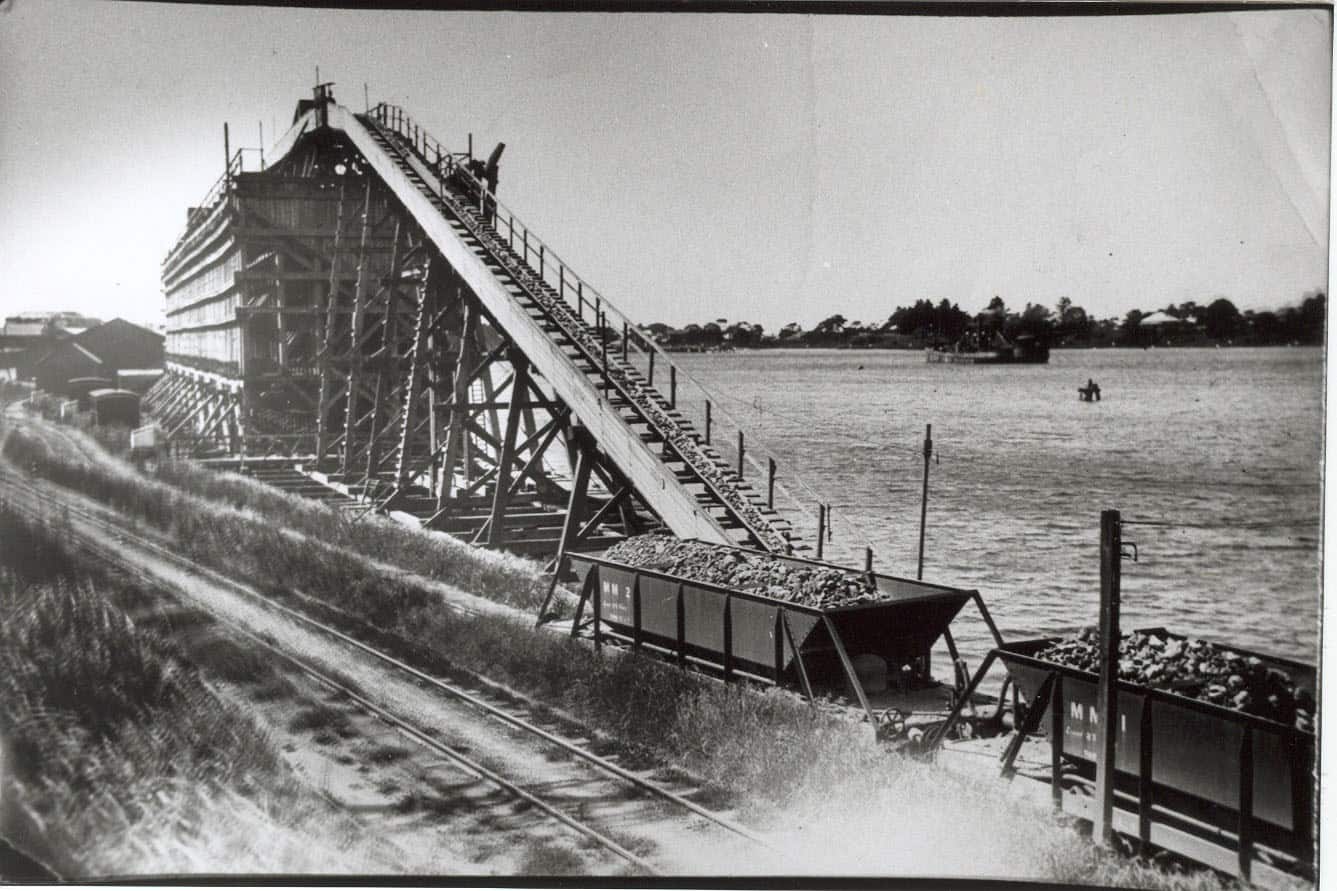
Limestone depositions of the Melrose-Eugenana region were quarried for smelters of BHP. In 1916 the old Don Railway was rebuilt by the government to bring the limestone from Melrose to the Devonport wharves.
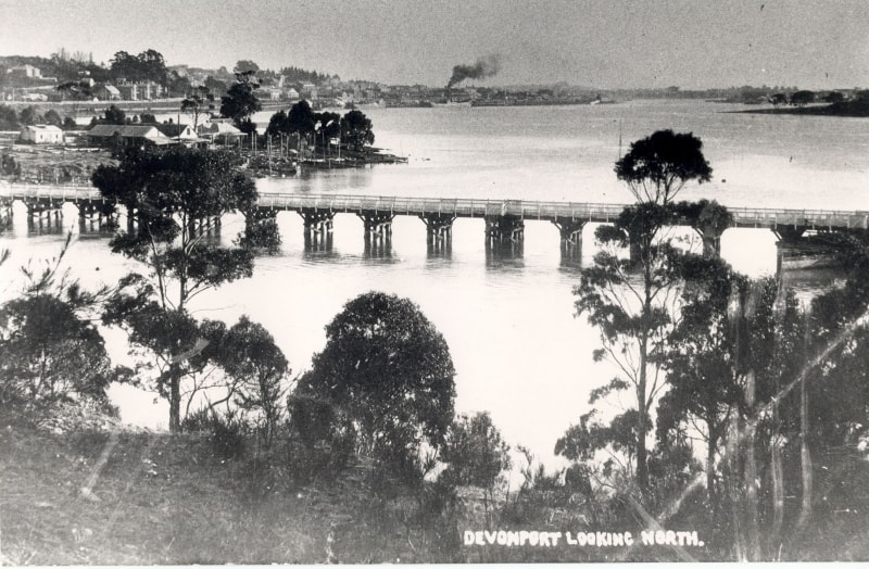
In 1924 the Victoria Bridge collapsed as a result of the continuous boring by Teredo worms. There were no casualties, and the bridge was partly rebuilt and strengthened.
Industry continued to develop and grow, and in 1926 one of the largest industrial complexes in the North West, the Goliath-Portland Cement Company was established at Railton. The 1930s saw the introduction of the motor car, street sealing pushed ahead, main roads were improved, and goods were moving faster.
The 1950s were years of prosperity and expansion. Many secondary industries moved to Devonport, and with them transport and service industries, businesses, and a steadily increasing population. In 1952 the aerodrome at Pardoe was opened, and regular airline service between Devonport and Melbourne commenced.
The Roll On Roll Off (RORO) Terminal at East Devonport was established in 1959, and the ferry service operated by the Princess of Tasmania began. The next two decades saw the town’s residential area spread west across the ridge into the Don Valley, north along the heights of Coles Beach, and south both sides of the river. During these years, Devonport was one of the fastest growing municipalities on Australia.
In 1973 a new concrete bridge replaced the old, battered Victoria Bridge, carrying the Bass Highway past Devonport. The city continued to prosper well into the 1990s, with the port to this day still it’s lifeblood, as it is fed by farming and manufacturing.
The Robinson Collection
The Robinson Collection comprises over 100,000 photographic negatives and was purchased by the Devonport City Council in 1993. The images, which vary in subject from portraits to land-scapes, street-scapes and crowd-scapes, were taken by Bert Robinson and his son Albert. Bert established the photographic business in Devonport in 1927. Following his death in 1953, his son Albert carried on the studio until he died suddenly in 1975, when the business ceased to operate.
The Gallery continues to present a series of exhibitions which interpret the Robinson Collection using a contemporary point of view, reprinting selected negatives from the collection in large format, in some cases using old photographic techniques to achieve tones and effects in keeping with the production of photographs during the Robinsons’ era. The Robinson Collection serves as a valuable resource for interpreting past social and political events on the North-West Coast, while providing an insight into the history of photographic practice.
Visit the Devonport Regional Gallery online Memory Bank – The Robinson Collection here.
Bass Strait Maritime Centre
Dame Enid Lyons opened an exhibition of maritime memorabilia in 1970, inspiring the development and establishment in 1973 of the Tasmanian Maritime and Folk Museum in East Devonport. In 1980, the museum moved to the Harbour Master’s house in Gloucester Avenue. In 1999, the museum and the Devon Historical Society amalgamated, bringing Devonport’s maritime and local history archives and objects together into one collection. In 2010, the Devonport City Council accepted ownership and management of the collection from the volunteer-based organisation.
Now, the Bass Strait Maritime Centre is Devonport’s local history and maritime history museum. The collection comprises around 4500 objects, 200 artworks, thousands of photographic prints and negatives, and decades of archival material that explores the stories of Devonport and the Bass Strait from the early 1800s to the present day. Rotating temporary exhibitions explore stories from the collection.
To access an index file of the historical archives, please visit the Local History Archives – Bass Strait Maritime Centre